


Jamaica
Elevation Map
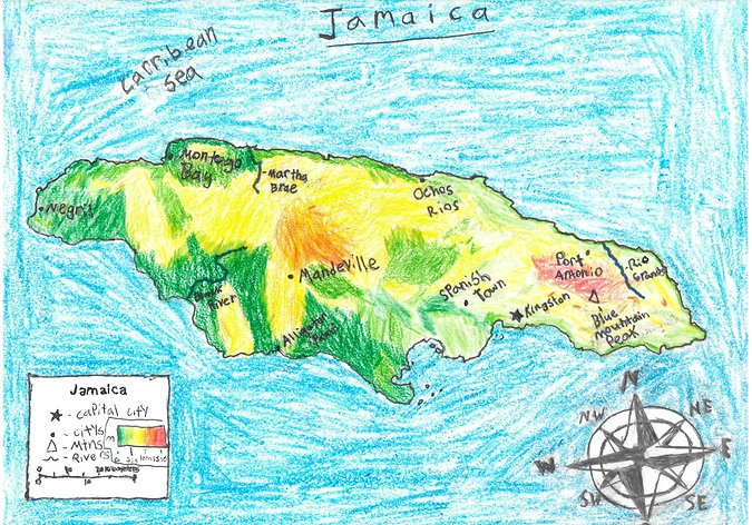
GEOGRAPHY
Jamaica is an island that is part of the 7000 islands in the Caribbean. Out of all those islands Jamaica is the third largest behind Hispaniola and Cuba. Jamaica has a total land area of 10,991 sq km (square kilometers) and extends 235 km from North to South and is about 82 km from east to west. Jamaica's coastline stretches to 1,022 km. Jamaica's topography consists of three main regions, the coastal plains around the island, the Blue Mountains in the east, and Limestone plateaus in the central and western parts of the interior. Blue Mountain Peak has the highest elevation through Jamaica reaching up to 2,256 km. Jamaica has a tropical climate at sea level and a temperature climate in the uplands. Although Jamaica is a tropical island and can reach high temperatures, it also experiences a lot of rainfall. The four seasons in Jamaica are mainly distinguished by differences in rainfall. There are two rainy seasons,these seasons stretch from May to June and from September to November. The annual precipitation is around 77 in, with the highest rainfall, 200 in, occurring on the Northeastern coast and the Blue Mountains. The lowest, 33 in, occurs around Kingston, in the Southwest. Moreover, the average winter temperature is about 75 degrees Fahrenheit. The summer mean temperature is around 80 degrees Fahrenheit. However, the temperature is about 91 degrees Fahrenheit in Kingston (the Capital city of Jamaica). Additionally, Jamaica experienced some hurricanes which usually happen from late August to November. In conclusion, The diversity of Jamaica's geography, with its different distances, elevations, rainfall, and temperatures creates a sort of environment that influences both its climate and ecosystems.